May
31
2010
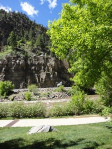 I have been driving through Glenwood Canyon my entire life, first as a passenger in my younger years, and in later years as a driver. On rare occasions, I even ride my bike in the canyon. In my younger days I used to be terrified of driving through the canyon. In those days it was a two twisty road. What really got me though was how close it was to the river, and more importantly the lake caused by the dam for the powerplant. In my young eyes, I often worried about driving off the road into the river.
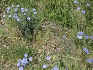
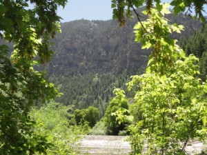
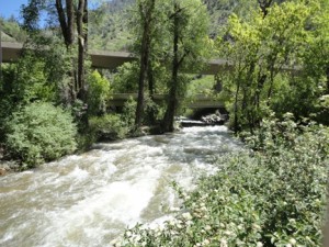 These days, Glenwood Canyon is one of my favorite places with it’s sweeping highway, numerous rest areas, the bike trail, and of course, the breath taking scenery. This year we visited the canyon during Memorial Day Weekend. They canyon is gorgeous right now with most everything in bloom.
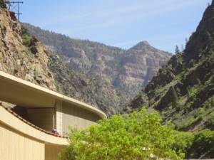 The construction of I-70 through the canyon caused years of lawsuits by environmentalists, years in design, and the better part of the 80’s in construction. The result however, in my eyes, is one of the most beautiful stretches of highway I have ever been on. Not only is the highway an engineering feet, it is also a
 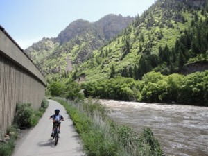 work of art. The highway hugs the canyon walls, swooping through the canyon with tunnels, several bridges, and viaducts. A lot of care was taken to preserve as much of the vegetation as possible. You will see the highway going over full grown trees, skirting rock formations, and for me, getting the highway above the river!
Also incorporated into the canyon are four rest areas (quite amazing considering this stretch of highway is only 10 miles long), a bike path that runs the full length of the canyon, and launch areas for rafters and kayakers. If you are in the area, be sure to check it out.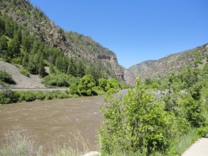
1 comment | tags: Bike Riding, Highways | posted in Landscape Architecture, Natural Environment
May
17
2010
Detroit has ambitious plans to demolish up to 10,000 vacant and derelict structures this year, most of them likely to be homes. This represents about 1/10 of the estimated 90,000 such structures in Detroit. One of the more notable homes to be torn down is the historic home that used to be the boyhood home of Mitt Romney. Ironically, it is located in a posh neighborhood. From pictures I have seen, it looks like it was undergoing a serious remodeling that was simply abandoned some time ago. This has a few people up in arms simply because of its historic nature. Of course, Detroit has far bigger problems than this one house, but it does have some magnificent homes, both in good condition, and those abandoned.
Detroit is one of those cities that is getting serious about trying to match the physical size of the city with that actual population. Long term plans for the abandoned areas arn’t known yet. Detroits mayor has been quoted as saying as large portions of the city will need to be rebuilt from the ground up when the time comes. I believe it, if streets aren’t used, much less maintained, they fall apart pretty fast. Then there is the water, sewer, and other utilities that decay rapidly, particularly in a humid and wet location such as Detroit. Some areas will be used for urban farms, but I suspect mother nature and forests will take over other areas.
With the current economic crisis compounding the problem, approximately 30% of Detroit’s housing stock is sitting vacant. That is a staggering number. Before the economic upheaval, there was already significant rebuilding and redevelopment going on, working from the downtown area outwards. That has now stalled, but that concept is hardly unique to Detroit.
I find urban decay as fascinating as development and construction. Maybe even more so, watching how fast the built environment can disintegrate when abandoned. What do you all think?
no comments | tags: Development, sustainability | posted in Development, Historic Preservation, Landscape Architecture
Apr
24
2010
The City of Fort Collins is undertaking two projects this year that will have an impact on the entire city, and on the east side-west side neighborhoods in particular. The first is the update to City Plan, the overall guiding document for landuse within Fort Collins. This project is being dubbed, Plan Fort Collins. You can get more information at the city’s website.
The other project that is being tackeled is studying the design guidelines for the Eastside Westside Neighborhoods. This excerpt is from the City’s website
“Eastside & Westside Neighborhoods Design Standards Study is a study aimed at addressing the impacts of residential development occurring in Fort Collins’ oldest downtown neighborhoods. Small houses are being expanded or replaced, resulting in new houses often significantly larger than the original. This type of development is commonly referred to as “pop-ups” (additions) and “scrape-offs” (demolition/replacements), and is a frequent topic of public discussion since the early 1990s.”
The focus on these projects is on development and redevelopment opportunities within the city. As the city quickly runs out of buildable greenfield sites, there will be more and more pressure to redevelop and so called infill projects. The question is not when or if, but rather how and where it will occur. A big challenge is creating compatibility between existing and new. There will be continued pressures in the old-town area, and significant pressure on the Mason Corridor, and the city is also looking heavily at the so called mid-town area, basically surrounding Foothills Mall.
One of the big things I have been harking on for the last couple of years, is the need for the city to identify areas of town that are appropriate for redevelopment, and those that arn’t. There are significant pressures to rebuild portions of Old Town. There are areas though were redevelopment should be restricted to preserve the character of the neighborhood and town. Old Town itself is a major community identifier for Fort Collins, and is a tourist draw of itself. Mountain Avenue is another of those those areas that has a unique character with a mix of stately and worked homes, wide median, and an historic trolley running the length of the street. Then there areas that are more appropriate for redevelopment, such as Luarel Street across from Colorado State University.
Community dialogue needs to happen to help shape the future direction of not only Fort Collins, but communities across the country. As it becomes less feasible to develop greenfield sites, cities will start to rebuild with higher densities, higher structures, etc. I am in full support of this, but it must be done carefully with careful attention paid to the details of architecture, site planning, space creation, and creating public and private spaces.
5 comments | tags: downtown, new urbanism, sustainability | posted in Development, Historic Preservation, Landscape Architecture, New Urbanism, Uncategorized
Feb
12
2010
When we were roaming around Berkeley on one of the pedestrian connections I mentioned, we stumbled upon the famous Rose Walk. This space is simply fabulous. What is it you ask? It is an open space pedestrian courtyard surrounding by an eclectic collection of highly detailed homes. Automobile access is from the rear, with alley loaded garages. This space has a plaza, and is extensively landscaped, including roses. I have been designing and pushing neighborhood planning like this for years, and was very pleased to find this space, built around the 192o’s I guess from the style of architecture. There is no front yard demarcation, all the spaces blend into one larger space. Wouldn’t a place like this be fabulous to live in?
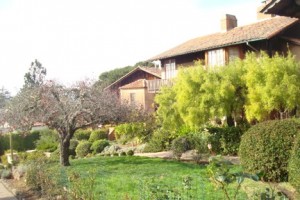 This open space is heavily landscaped.
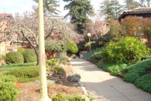 Gorgeous!
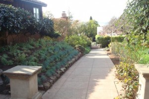 This walk leads to adjacent streets.
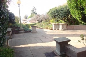 This is a classic pedestrian plaza, complete with seat walls.
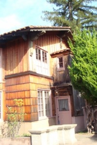 Check out the detail on this fabulous home. While the styles vary, this level of detail is typical.
2 comments | tags: Development, gardening, Historic, street scape | posted in Development, Historic Preservation, Landscape Architecture
Feb
12
2010
Well, I don’t know if this is the official downtown, but these were taken from the business district on several sides of the UC Berkeley campus.
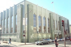
This is the fabulous historical library in downtown Berkeley. I admit when, I first saw it, it was dark, and I thought it was an ugly dismal building (I also had a few great beers in me), But when I saw it the next day, and also learned what it was, wow!
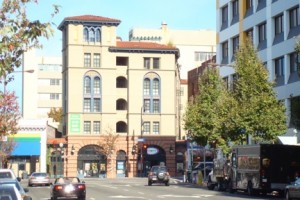
This is a new building that fits in extremely well in its historical surroundings. It is all about compatibility ( a very subjective term, I realize).
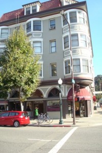
Only a block from the new building. Check out the round corner windows. yes the windows really are curved. They don’t build em like this anymore.
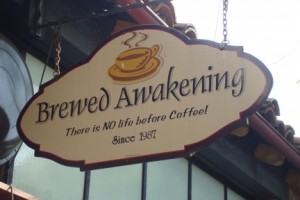
For all you coffee lovers out there.
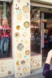
And finally, for you art lovers, this gem was taken in the student hangout section west of the campus.
For more pics, visit my Picassa Web Album.
no comments | tags: downtown, new urbanism, street scape | posted in Development, Historic Preservation, Landscape Architecture, New Urbanism
 I have been driving through Glenwood Canyon my entire life, first as a passenger in my younger years, and in later years as a driver. On rare occasions, I even ride my bike in the canyon. In my younger days I used to be terrified of driving through the canyon. In those days it was a two twisty road. What really got me though was how close it was to the river, and more importantly the lake caused by the dam for the powerplant. In my young eyes, I often worried about driving off the road into the river.
 These days, Glenwood Canyon is one of my favorite places with it’s sweeping highway, numerous rest areas, the bike trail, and of course, the breath taking scenery. This year we visited the canyon during Memorial Day Weekend. They canyon is gorgeous right now with most everything in bloom.
 The construction of I-70 through the canyon caused years of lawsuits by environmentalists, years in design, and the better part of the 80’s in construction. The result however, in my eyes, is one of the most beautiful stretches of highway I have ever been on. Not only is the highway an engineering feet, it is also a
  work of art. The highway hugs the canyon walls, swooping through the canyon with tunnels, several bridges, and viaducts. A lot of care was taken to preserve as much of the vegetation as possible. You will see the highway going over full grown trees, skirting rock formations, and for me, getting the highway above the river!


